We arrived on the shore of New Foundland, which is by all intents and purposes a rock off the coast of mainland Canada, at approximately 6:30 am this morning. A little dazed after spending the night on the boat, we stumbled down to the vehicle deck and our unloading went surprising quickly. After hopping off at the first sight of grass to let the dog stretch his legs, we stopped at the visitor center. Much to Lindy’s dismay I emerged with a fresh stack of maps, books, and brochures to clutter up her side of the truck. I had also managed to get a map and list of all the lighthouses on the island from the gal at the desk, something they don’t put on the shelves, we were in business. Just up the road from the info center was Cape Ray, which just happened to have a lighthouse, and what a lighthouse. Finally a real tower, constructed of brick, not these dorky little wooden shacks with a light bulb we’d seen thus far.


Heading out of town, Lindy glanced at the map and noted a thinner, red line, that seemed to parallel the highway but follow the coast. After a few dead ends we found it, a gravel 2-track leading towards the shore, perfect. After bouncing down the track, it became apparent that ATV’s are the preferred mode of off-highway transport on the island, as all the paths leading off the road were significantly narrower than our truck. Finally, we came to a bridge, and to our disappointment, a sign that cars/trucks were prohibited and two perfectly spaced boulders to drive the point home. We turned around and headed back, found a shortcut through a creek, and hit the tarmac again.


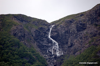
As we crested the hill on the highway though, it became apparent that this was unlike any place we’d been before. Not only was the highway void of signage holding tourists hands to guide them to the sights, but the terrain looked like something that was out of this world. That wasn’t a ferry we were on, it was a spaceship. We were now on another planet.

We had decided to split up from Mike at the light house and meet up again further up the coast at St. George, the next semi-bold town on the map up the highway. Again and again we saw gravel roads leading straight off from the highway, and we kept ducking off to follow bits of the thin red line on the map. More and more I became suspicious that this wasn’t a former road, but actually a railroad grade. It was far too flat with smooth corners to have been a road of such a narrow width. Eventually, at a particularly interesting intersection of gravel roads in every direction, I dug up a chunk of steel that was protruding from the earth. What it is, I have no idea, any ideas railroad afficianados?
After another detour, we found ourselves in a culvert pipe under the highway, and after turning around, spotted a marker denoting this as part of the International Appalachian Trail. About that time Lindy also found a key on the map noting it as part of a “Provencial T’Railway”, mystery solved.
When we hit St. George, there wasn’t much to see, so we shot Mike a text and headed further out towards the cape. We stopped at our first real roadside attraction of the trip, an Alpaca farm on the cliffs, right on the Gulf of St. Lawrence. Lindy found a hat, or toque, as the local girl at the desk corrected her, and we proceeded on towards the Cape. At some point we decided that the peninsula that was north of the cape, complete with ~15km of unpaved road, would certainly be more interesting. What we found there was awesome, at least in our minds.


Dropping down the hill we saw a fishing town, but unlike all the ones we’d been through the days before, it was completely empty. There were relatively modern vessels, and some recent signage, but everything else could have been out of the earlier part of the century. There were empty shacks all up and down the “road” that went towards the point, and gorgeous views of the sea and the mainland. Since it was close to lunchtime we had ourselves a picnic and walked the area before taking some photos and heading back out.
We set our target for the night at Blow Me Down Provencial Park. Make all the cracks you want about the name, but it was a nice campground set near the coast after a beautiful drive along the bay. Eventually, Mike finally joined us and we fixed our dinner on the campfire.We had pizza pockets Lindy fixed in the pie iron and Mike grilled steak over the grate on the fire pit. We hunkered down for the impending passing of tropical storm Irene and dozed off.


