Monday, September 5, 2011

Day Seventeen - Out of Labrador and into France?

Highway 389 is Quebec’s only link to the Trans Labrador Highway. We spent most of our day trying to make good time on the mix of paved road, gravel, road work and railroad crossings. On every trip, we always have a few days dedicated to travel. Still, as we wove our way South through the back roads of Quebec, we did have a few roadside distractions.

Leaving Labrador City, we made the crossing into a new province. The change was immediate as all the signs went from English to French. Stopping in the mining town of Fermont, we sought out the visitor center and stopped to gawk at a mining truck they have converted into a park decoration.

Can you spot Carl in this picture? 


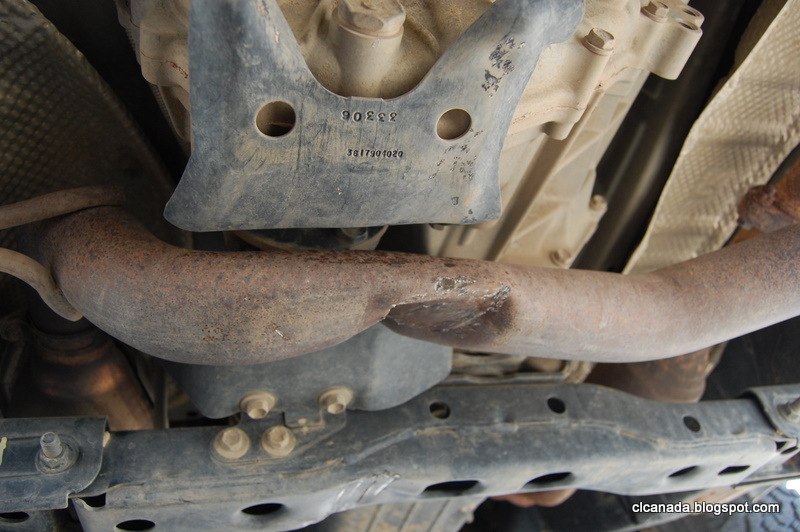
Back on the road, we were shocked to see the Mt. Wright mining effort. There is an entire mountain being strip mined and moved around right near the highway. The most shocking thing to me was the red muddy river that flowed through this area. It was the first contaminated water we had since in days, maybe on this entire trip, and the color was so brown you could not process that it was actually a body of water.


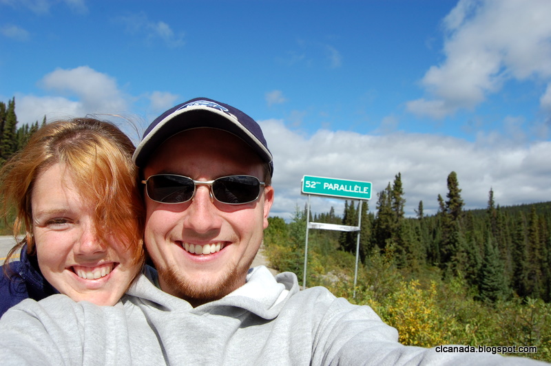
There are several moved or abandoned mining projects in this region. Every now and then we would spot old signs and structures like silos. We also kept an eye out for the ghost town of Gagnon. This mining town was operational until around 1985 when the entire town was sold off and dismantled. Driving down the dirt road, we suddenly encountered a paved road with a median, curb and sidewalk. There were even manholes in the road. There is no way to fully describe the eerie feeling of coming across the infrastructure for a thriving suburbia in the middle of absolute wilderness. Somewhere during this time, we also crossed the 52nd parallel.


Shortly after the “town” of Relias Gabriel we pulled off on a path that lead down to the water. The reservoir here is part of the giant Manic-5 dam complex that we would encounter later in the day. It is also the remnant of a pre-Cambrian  meteor crash which gives the region its shape.


After kilometers of gravel, we finally found the paved road. About this time we also caught our first glance of the Manic-5 dam. The roadway originally drove across the top of this structure, but in recent years they have re-routed the road to weave down beside the dam. Still, it was impressive. The sheer size of the structure is overwhelming. Pictures do not do it justice.


While preparing for this trip, my research had shown that tours of the dam were given during the “Summer;” it turns out that the Summer season ends on August 31, and here we are on September 3... Another Dam Tour missed by just a few days.

We had originally planned to camp near Manic-5, but since Relias Gabriel turned out to be nothing but a gas station and there was no tour to take up our time, we decided to push on and make up a day in our itinerary. Arriving in the outskirts of Baie-Comeau, we stopped at the Manic-2 camping grounds. As soon as we saw that EVERY sign on the property was in French, we knew that we were in for an interesting night. Thankfully, there is one staff member who does speak a bit of broken English and between that and the use of my Driver’s License, we were able to fill out the registration form; of course, they think my name is Marie Lindi.

So here we are, in the middle of Quebec, knowing next to no French and camping with an entirely French speaking crowd…. And we are having a blast. Tonight there is a huge bonfire, complete with a burning picnic table, and a concert in the public tent. I have already heard the French version of “Down on the Corner.”

Sunday, September 4, 2011

Day 16 - Churchill Falls

Last night we ate well, rested well, and showered well. Ready for the next part of our journey on the Trans-Lab we climbed in the truck and set off. There are a lot of efforts going on to improve the highway. One of the reasons we wanted to do this trip when we did was so we could experience what it was like to drive this road, and access this area, prior to it being spoiled by a paved highway. Pavement, did I mention pavement? Oh yes, we are certain that in the next 10 years this whole road will be paved. As we left out of Goose Bay we enjoyed several miles of pavement, many more than the map from a year ago even showed. Before long this will be just a Sunday drive, rather than a strenuous trek through the wilderness.

Not far out of Goose Bay you hit Muskrat Falls. Not only is this significant for being a beautiful showing of nature’s power as the water rushes over the rocks, but it is also facing impending doom. Nalcor, the local hydro-electric energy company has plans to build a massive dam here in the pending years, destroying the beauty of the falls. We were happy to see it when we did.


Home-made signs for the hiking paths

Halfway between Goose Bay and Labrador City is Churchill Falls. This place is a bit of an anomaly. The town is a company town, whose sole existence is to support a hydro-electric plant, by the name of Churchill Falls. Churchill Falls, however, no longer exist. The river, which once drained several large basins on its trip out to the sea, featured an enormous drop that we could only imagine, since the water has now been diverted into an immense power plant that houses 11 turbines thousands of feet below the surface. The guidebooks say to inquire about a free tour at the town office, so we did. Apparently though, there is a vacancy for a tour guide here, as one tour guide was on vacation, and the other up and quit. While the extremely friendly attendant at the front desk was explaining the situation and giving us key chains, a supervisor piped up from behind and asked if we’d like to see the video. Basically we ended up with a private 1st half of the tour and question/answer session, along with directions to view the previous location of the falls and being instructed that we could drive practically anywhere on the property so long as there were no gates. This included the tops of the dikes, sweet! He even drew us a map to some key areas to check out.


A little ways outside of town we found the trail to the former falls. Though there are still a few streams feeding them, it is not even a fraction of the magnitude of water that previously flowed here. You could see the contours of the rocks, sculpted over the years by the power of the river that once flowed here. A shame really, but that’s progress, and as an engineer I have to respect what they were able to visualize and achieve, despite the loss of a great natural feature that we’ll never see again.


JD braves the metal bridge on the trail. 
Other than that the day was pretty uneventful. Leaving Churchill falls the road is under a lot of construction as they widen it in preparation for asphalt. It feels like you’re driving through a construction site at all times on this road. Imagine being able to drive I-95 before it was paved and opened, that’s about what we’ve been plowing through lately.

We knew there’d be camping in Lab City, but had no real idea what to expect. The only guidance we had was from 2003, so who knows what things were like 8 years ago. Pulling into the only campground in town, Duley Lake Family Park, we couldn’t quite comprehend what we’d stumbled upon. Imagine the Pikey camp from the movie ’Snatch’, and you’d get a pretty good idea. Still, it seemed like mostly a bunch of families living out of their trailers for the summer having fun, and we didn’t have much of a choice, so we nabbed a spot next to the lake and set up for a very wet, windy, night.


Day Fifteen - TLH pt.2


We camped last night right on the bay in Cartwright. It rained overnight but was clear by the time we woke up, aside from a thick layer of fog that quickly burnt off.


We topped off on fuel in town and headed back south to rejoin 500N, the Trans Labrador Highway. One thing about this road, in most places there is no shortage of beautiful scenery. Lindy even commented once “It’s too easy”, while she was trying to take photos of the landscape. The road frequently crossed brooks, streams, and rivers, previously inaccessible to man.


Out on the road we made good time on our trek to Goose Bay/Happy Valley. The roads were smooth and we were able to carry a lot of speed. At one point about 100km from Goose Bay we came across a minivan at one of the pull-offs. It was a couple of, for lack of a better term, hippies from Montreal we’d seen on the ferry heading to Labrador two days before. They had a poorly-repaired flat and needed an air compressor, we were glad to be of service and enjoyed chatting for a while about our travels thus far. While we stood and talked, a gray-jay flew up, edging closer and closer as we joked about how bold they are and soon enough, he was in the hippies’ van. As they walked over to chase him away, he came flying out the door with a snack, a cookie he’d managed to extricate from the cupholder. We cracked up about it for a few minutes and then got back in the truck. As we headed off we came across a reminder of why you must not let your guard down on this road, a Chevy Blazer on it’s side, roof crushed in but no one should have been hurt if they had their belts on.

As we neared Goose Bay the tank got close to E, then the low fuel light came on, then the needle went past E. I knew from previous days we’d be close on mileage, and had a spare 2.5 gallon can with us, so I wasn’t worried. A few kilometers later, we came up on a road grader. We’d past several over the last 2 days so this was nothing new, but as the road narrowed and we moved over to straddle the row of debris he’d piled up on a previous pass, we heard a loud thud followed by a jolt that rocked the truck. Everything in the center console had found new homes. The change was in the floor, cups and bottles knocked out of the cupholders, and the gearshift knocked into neutral. I quickly looked out of the mirror and saw a giant rock bounce off the side of the road. “What the !@#$^????” I stopped and did a quick inspection, saw no fluids leaking, so we eased down the road a little further before finding a good pulloff for an inspection. This is roughly equivalent to what we hit at about 60mph:


And this is what it did:


Initial damage assessment showed denting and tearing in the front skid plates, a gouge and dent in the driveshaft, and some marks on the rear axle. When we got to town and found a lot to pull off in I crawled under and pulled the skid plate off. There was a hole torn through and an impact crater in the front diff, but no apparent damage aside from superficial. It nearly flattened part of the exhaust and nailed the cross member under the trans, but both look like they’ll be serviceable for the return trip home. All in all lucky I guess, but still pretty pissed that we hit it in the first place.


We explored the town(s) of Goose Bay/Happy Valley, which have grown together over the years, and kicked back at the local RV park for much needed showers and internet time.

Thursday, September 1, 2011

Day 14 - Red Bay to Cartwright, via gravel

When we arrived in Red Bay last night, it was close to 1:00 AM, thanks to our late night ferry experience. As a result, we didn't get to see much of the town. When the sun peeked over the hills, though, we were delighted to find a really nice little fishing village (not that we hadn't seen any of them thus far). We had been directed the night before on the ferry by an enthusiastic local to go to yet another Canada National Historic Site. This one, though, was generally for the Basque fishing heritage in the bay, but specifically for the discovery of a Spanish galleon from the 16th century, the only one known like it in the world.

It seems there was a lot of discovering going on in this part of the world in the 60's and 70's, as some documents uncovered at a Spanish university led researchers to believe there was a significant shipwreck in the bay. Since a recent wreck had happened in the vicinity under similar conditions (which is still there, by the way), they were able to approximate the location of the Spanish wreck. Sure enough, under roughly 10m of water, lies an almost perfectly preserved Spanish galleon in pieces, to this date. This led researchers to discover an entire settlement, and smaller wrecks as well. One of which, a smaller whaling vessel, has been recovered and preserved and is open to the public. We geeked out appropriately, and enjoyed the morning soaking up this piece of history, in a very nice museum setting.


16th century Whaler Boat on display. 

Model of the Spanish Galleon located at the bottom of Red Bay. 

Local Fishermen.

Shipwreck which helped locate the Spanish Galleon on the bay floor. 


Inukshuk at Red Bay. 

Finally we left, topped off with gas, and made the turn onto the Trans Labrador Highway.

The Trans Labrador Highway, or TLH, is basically the only public road through the province. It is largely dirt and gravel with portions through the larger towns paved with asphalt. There are still areas of Labrador that can only be reached by ferry or plane. The TLH was constructed in three parts. The first, connecting Labrador City to Happy Valley - Goose Bay, was completed in 1992. Additional efforts in 1999 and 2009 completed a full highway system from Red Bay to Labrador City. Paving efforts continue on the Labrador City - Goose Bay stretch, but from Red Bay to Goose Bay there is nothing but dirt. You can read a bit more
here or here.


Along the roads lie a number of wooden sleighs, presumably to pull wood out of the forests in the wintertime, we still need to pose JD with one, since he is our sled dog.


We hit some of the smaller towns along the road, Mary's Harbour, St. Lewis, and Port Hope Simpson, none of which really offered a lot in the means of tourism, save a boat tour at Mary's Harbour to another island. When we pulled into Port Hope Simpson we had a bit of quandry: continue for a while or stop for the night. After fueling up we decided to check out the local "accommodations". There's a hotel that looks closed, a B&B that looked OK, and supposedly an RV park. It's such a stretch to call this an RV park that we completely missed it on our fist pass, and had to get directions back to it. When we pulled up we found a few sites in an over-grown lot, and what looked like a temporary office trailer. Not certain that they even had a bath house, we checked in the office, which was also the local hardware store, where we met the most useless and unfriendly person to date on this trip. After an awkward hello, the conversation spiraled down hill to the point that I wasn't even sure she wanted to rent us a site for the night, and I was determined not to pay this lady to stay at her crappy campground. So we pressed on...unsure of where we were actually heading for the night.

Port Hope Simpson also has the distinction of being the last place to get gas before Happy Valley - Goose Bay, another 415km away. About 100km in we found the turnoff for Cartwright, which is a ferry stop 100km off the highway on a bay. Since it was getting late we opted to head north to Cartwright, which is also the farthest north we can drive on the east coast, and find a spot for the night.

The Skamper, on the other hand, wasn't sold on the idea, and voiced its opinion by jettisoning the propane door out into the highway. Luckily I heard it breaking free, saw it out of the corner of the mirror and was able to get back to it before one of the other vehicles on the road could smash it into an unrecognizable shape. A little worse for wear, I made a hasty duct tape repair and we were back underway. Unfortunately, this would not be our last incident on the highway....


The landscape here is completely unbelievable and indescribable. We have never seen such blues and greens in our lives. It is amazing to think that this land was nearly inaccessible prior to the TLH, and is virtually untouched as a result.


Inukshuk and dog. 

A friendly local warning in St.Lewis... still now bears to be seen!